Part of me really didn't want to get up today because I knew it was going to be a hill climbing fest as the road headed inland and up into the mountains on the way to San Francisco. On the other hand, there was going to be some really nice sightseeing opportunities among the redwoods, so I eventually forced myself to get up and get moving. Once again I didn't eat breakfast, because I've now finally shifted into my regular long-distance cycling pattern of eating only a small late lunch, if anything, and then a huge dinner that I spend all night digesting. That's what gives me my fuel for the next day. For whatever reason, my body seems to prefer this to breakfast because once I get into this rhythm, eating anything in the morning makes me feel queasy until the afternoon.
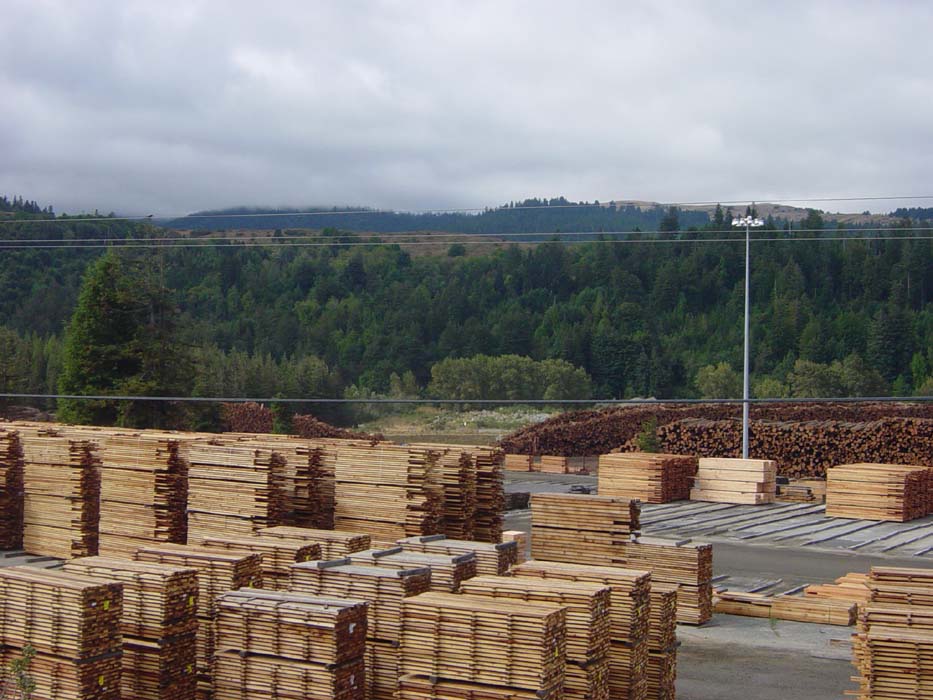
So I set off, taking the advice of locals and taking a side street as far as possible before getting back on the freeway. While riding along I passed a gigantic lumber mill which probably explains why I've been seeing so many logging trucks in the area. This is an awful lot of boards, and even more logs in the background waiting to become boards. By the way, the stacks continued off to either side of this picture for a considerable distance.
Eventually I did have to get on the freeway, and as soon as I did, I came to a bridge over this:
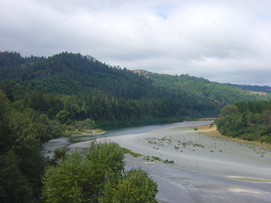
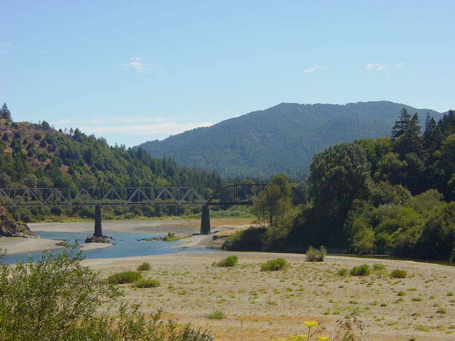
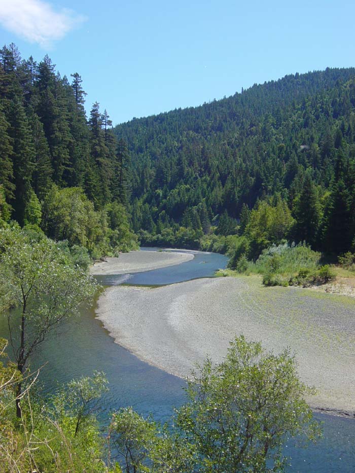
This rather uninteresting looking stream is the Eel River, which as it turns out would be my companion for the day as I followed it upstream for over 70 miles. This is one of the reasons I knew I was going to be climbing all day--if you're following a river upstream, you must be going up. Here's another view of it from a bit farther on, and it actually looks a bit better with the nice scenery all around.
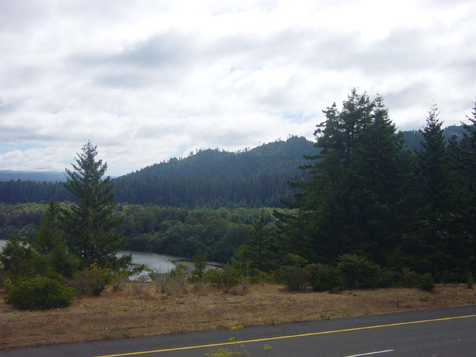
Also notice the clouds. These would fade within an hour or so, leaving the skies clear until afternoon. Plus, since I was inland, it was warmer, so I got to roll up my sleeves and not shiver during the occasional descent. I left the sweatpants on, though, because I hadn't used sunscreen on my legs and it was now packed up in my panniers and difficult to get to. Plus, the sweats give an extra layer of padding on the seat, which is a good thing too.
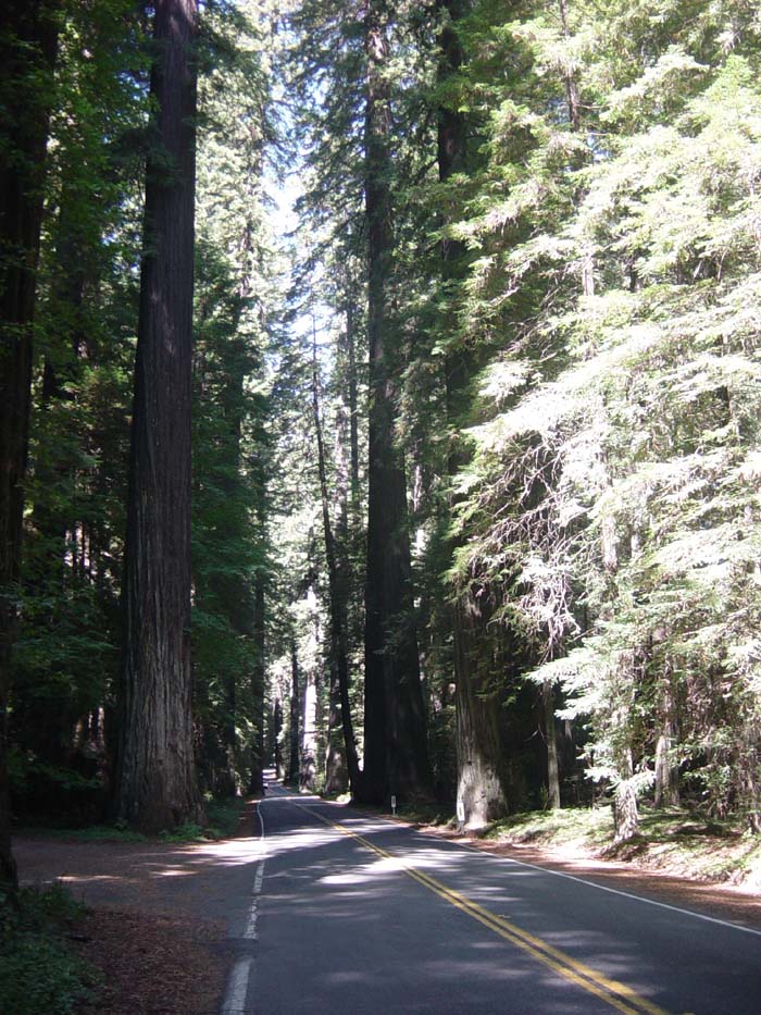
Anyway, eventually I came to what I'd been looking for, the entrance to a scenic section of road called the Avenue of the Giants. This is a 30-mile stretch of two-lane road running through an old-growth coastal redwood forest. This forest here, in fact.
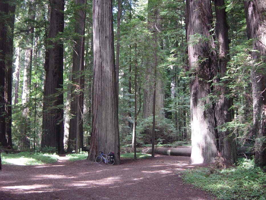
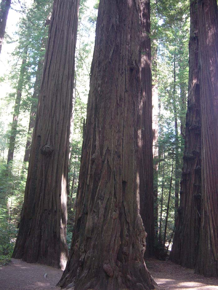
Naturally I got right off the freeway and headed onto the Avenue of the Giants (that's is the actual name of the street, by the way), even though I knew the ride would take longer and probably would be more hilly. You might recall I checked out another similar redwood forest a couple of days ago. Well, that was small potatoes next to this. The previous area was a mixed forest, and also very cold and damp, whereas this was almost exclusively redwoods and was quite a bit warmer. Plus, there were plenty of places to pull over and take pictures like this one.
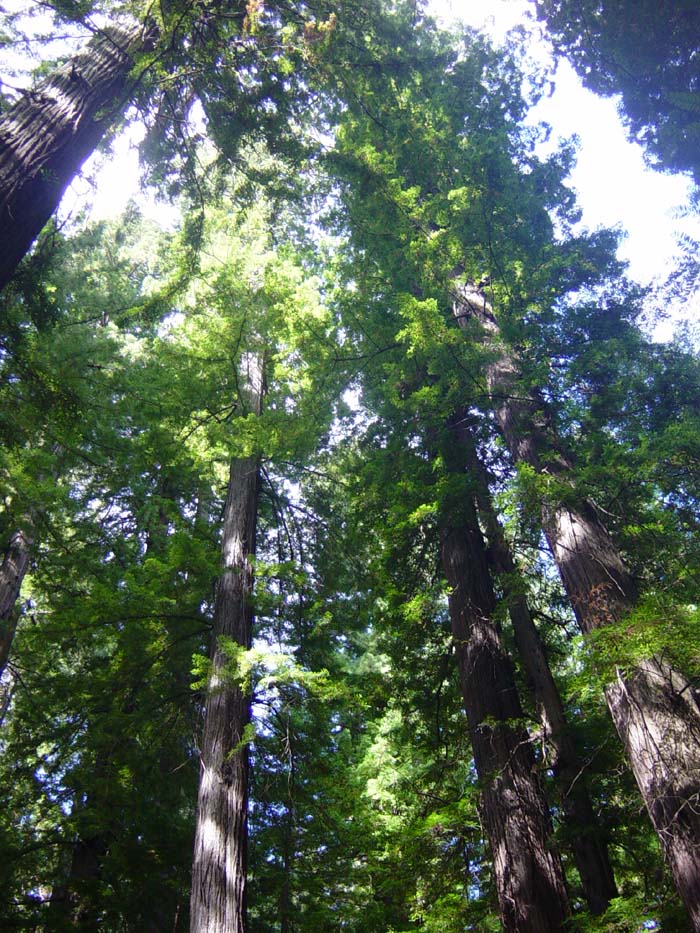
These trees are just amazing. If you throw back your head and look up, they seem to just disappear into the sky.
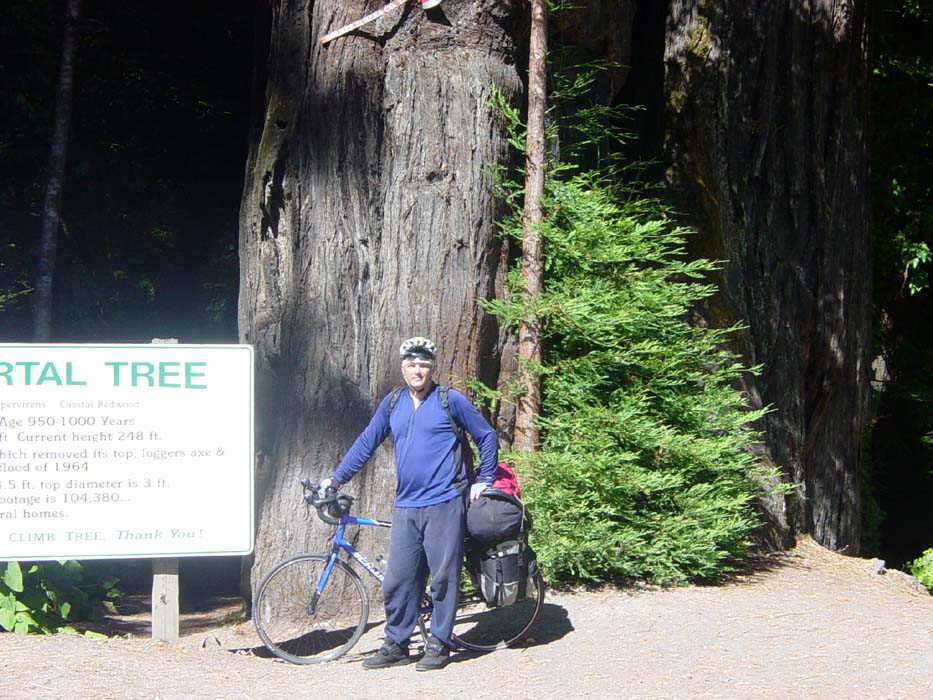
In addition to the miles and miles of trails and groves, there were also a number of specially designated trees with individual histories. This one here, the "Immortal Tree," survived being hit by lightning, having its top cut off by loggers, and several other disasters. The sign there tells all about it, but the guy taking the picture failed to get the whole thing in there, unfortunately.
Oh, also, that's your first look at my new helmet (finally). It's much more compact than the old one, lets air in to cool off my head better, and has a sort of sun visor thing sticking out the front. Plus, it actually fits like a glove. I like it.
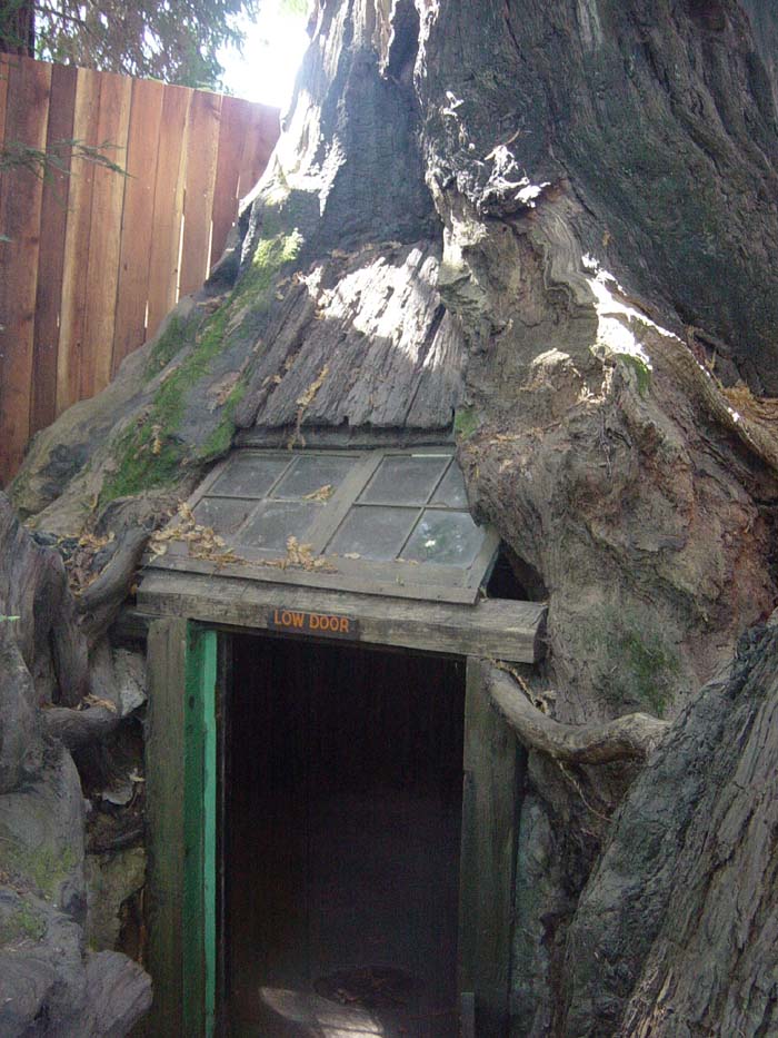
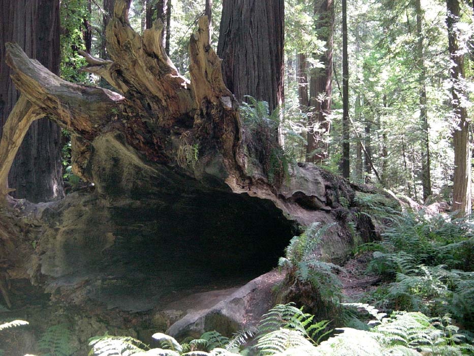
Here's another interesting thing I stopped to take a look at. It's a living tree house. You can step inside there and it's like a huge cavern inside. There's a brief history of this spot explaining that Native Americans, and later hunters and trappers, used to use this place as a rest stop. Loggers removed the trunk but more trees sprouted from the stump, so it's still basically alive.
Moving on, the redwoods seemed endless. Notice how they crowd the road. Sometimes, they would lean out over the shoulder so I'd have to dodge out into the lane (I had to keep my eye out for that as most of the time I was busy looking around at everything). The place was just amazing, and words really don't do it justice. Even these pictures aren't really giving you a sense of what this was like. You have to actually be here and just look around yourself to really understand. When you realize that some of these trees are over a thousand years old, that really puts things into perspective.
The 30 mile trip along the Avenue wasn't all nothing but forests and shade. Sometimes the road poked out into the surrounding hills. I was going upward most of the time, but only gradually, and quite honestly didn't really care because I wasn't in any hurry. Most of the time I just looked around myself in awe, pedaling steadily but slowly. There were little spots here and there where cars could pull off the road and park and you could read historical notes or redwood factoids. When I took this picture, I was looking at a spot where the Eel River splits into two forks (I would be following the southern fork the rest of the day). There was a major flood here in 1964 that wiped out a bunch of buildings and deposited all this sediment around.
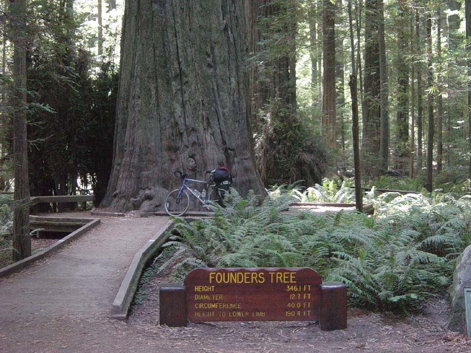
But anyway, back to the redwoods. Here's another spot where they had a placard explaining something about the history of the state park. Apparently, at one point loggers were going to cut down this entire area, basically destroying the last of the old growth redwods, but a group called the "Save the Redwoods Foundation" (or something like that) managed to gather enough money to buy up the land and save the trees. The government later matched the purchase price so as to turn the area into an official state park. To honor the people who made this happen, they named this huge redwood the "Founder's Tree" and made a kind of shrine out of it. You can read its statistics on the sign.
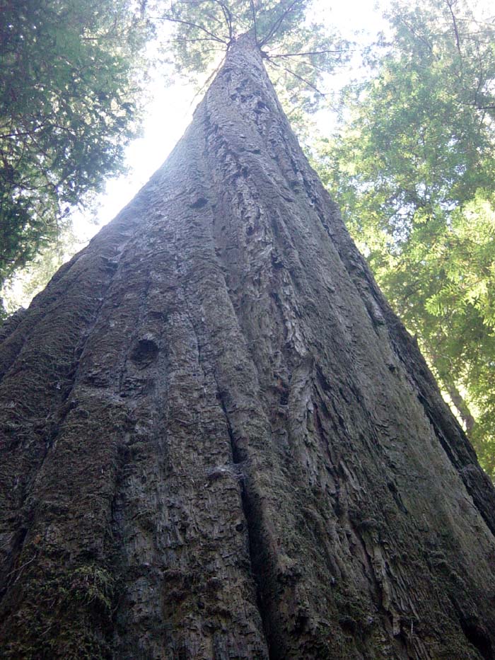
This is what it looks like from the base to the top. Remember, according to the sign, it's over 190 feet to those first couple of branches. I liked how the pattern of bark seemed to spiral upward, as if the tree slowly twisted around as it grew.
There were lots of fallen trees, including this one taller than myself, that I could've probably camped inside (if they would let me, which they wouldn't). Dead trees are, according to one of the signs I read, an important part of any old-growth forest ecosystem. An old-growth, or ancient, forest will have trees of a variety of ages and heights (thus enabling sunlight and rain to filter in through the canopy), as well as standing dead trees, and fallen ones. Even fallen trees that land in rivers and create blockages are a good thing, because they allow plants and animals to congregate in those places. Fascinating stuff.
Random Wildlife Sighting! Riding along, I came upon this monstrous snake that must've been twenty feet long! Just look at how humongous that thing is! I had no idea snakes got that big in this area!
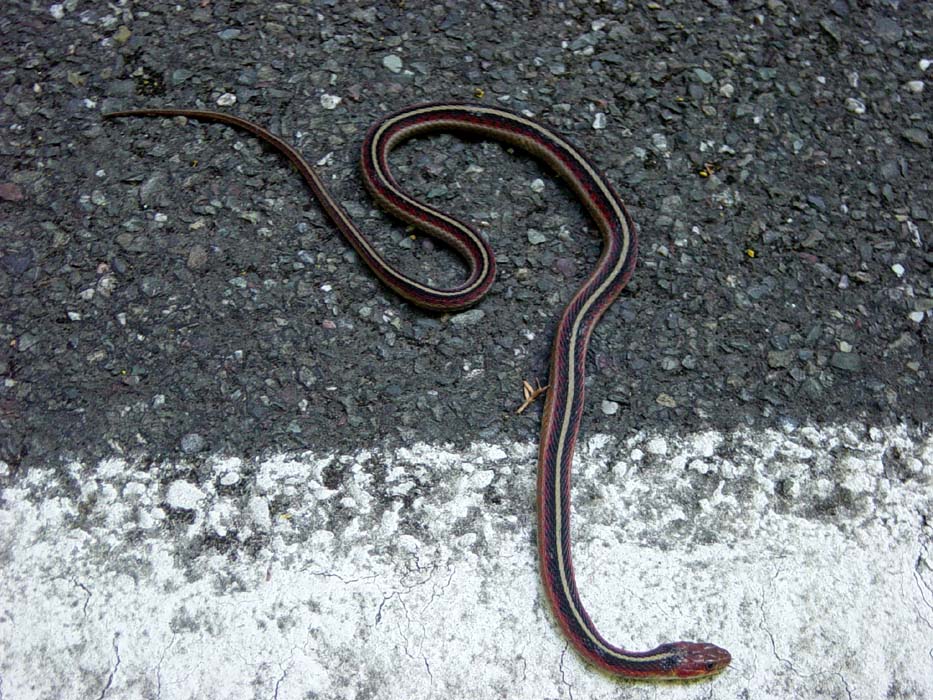
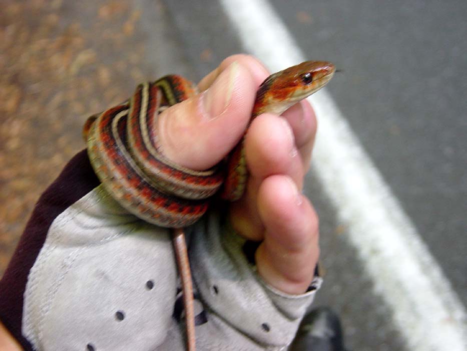
Okay, fine, it was just a little guy, maybe three feet long and probably not even that. But still, it was kinda cute, and I hadn't seen any with that red color before. Now, you can never be too careful when handling a snake, you never know if it might be poisonous, even though I was pretty sure this one wasn't. Just the same, I made sure I held its head like you see here, so it couldn't bite. In response it wound itself tightly around my thumb and was a bit tricky to dislodge after that. I let it go in the woods, and probably saved it from getting run over there on the edge of the road.
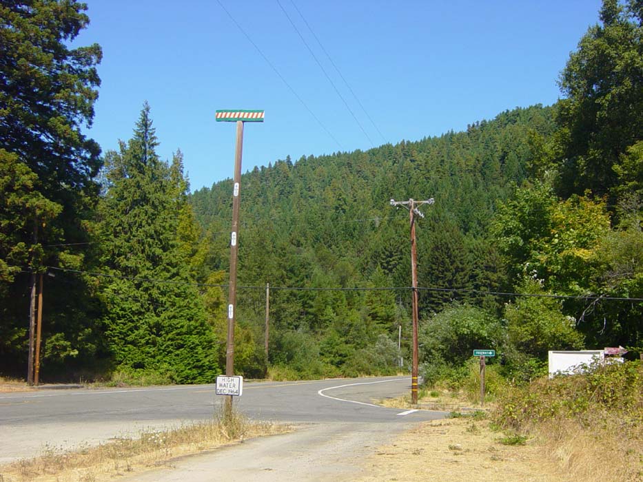
A bit later on I came to another spot where buildings had been destroyed in that flood I mentioned, and in fact there used to be an entire town here back in 1964, but it was totally wiped out. What happened was (according to the historical marker) there was a late winter storm that dumped a bunch of snow up in the mountains, and then a couple days later a huge rainstorm hit and dropped 32 inches of rain in a 24 hour period. Combine that with all the snow that got melted and you had a thousand year flood. See the post in the picture below, the one with the sign on it that says "High Water, Dec 1964"? Yeah, that one. Now follow the arrows up to the top of the pole. That's the high water mark. The area where I was standing was, in December 1964, under 33 feet of water. Now that's a flood!
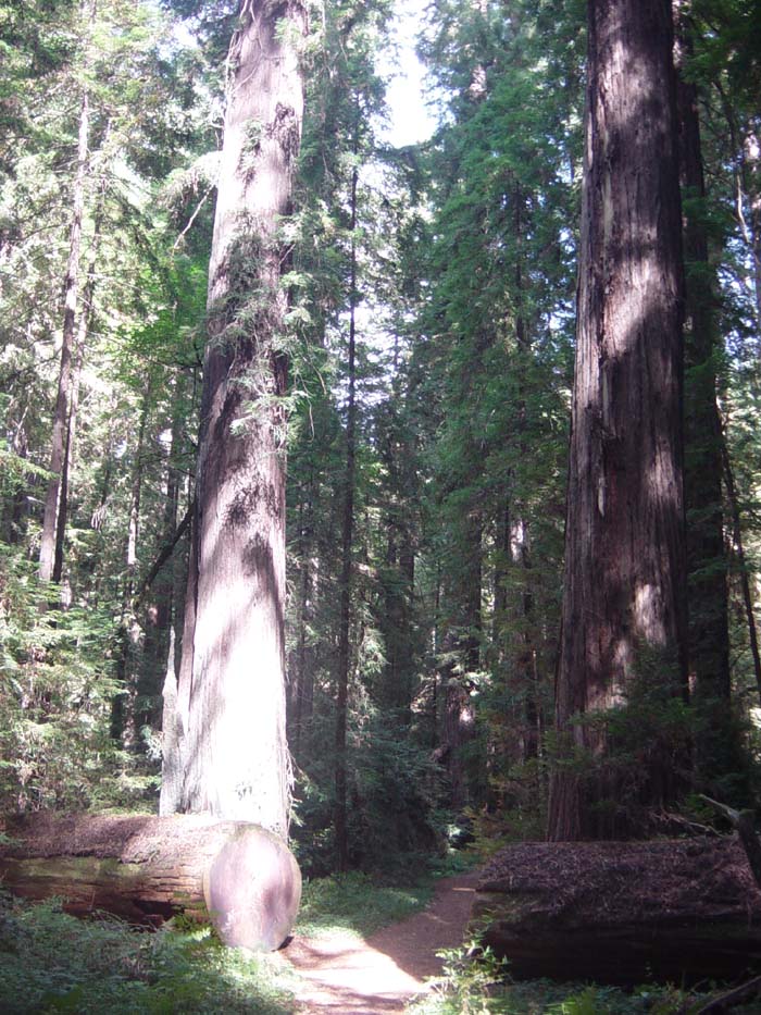
The road headed back into the forest for more amazing redwoods:
And then it wound back out into the sunlight just to remind me I was still following the Eel River.
By this point my journey through the Avenue of the Giants was nearly over, and I came at last to the final historical marker and hiking trail before getting back on the freeway. Just for the heck of it, I decided to try riding my bike through the trail, which was only about half a mile. This actually proved to be no problem whatsoever (the trail was packed gravel and very stable...a lot better quality than some of those awful chip seal roads back in Washington). This was actually the best part of the day. I was completely alone in this section of quiet, peaceful forest, surrounded by gigantic trees all around. Again, this is something that can't really be described, you just have to experience it yourself. If you ever do come here, make sure you try some of the hiking trails. Here's part of the one I rode through:
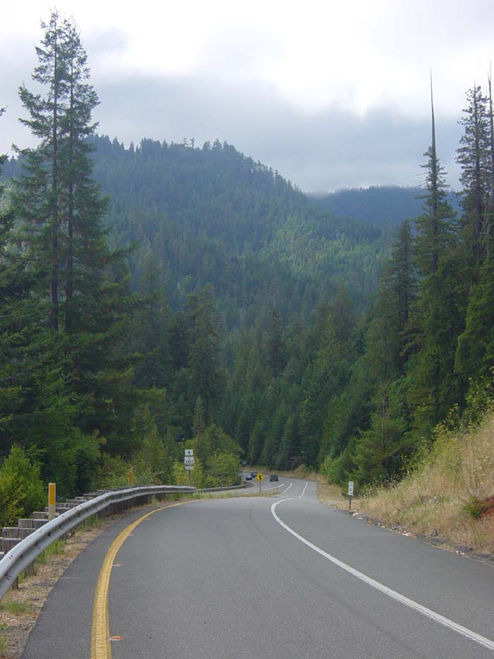
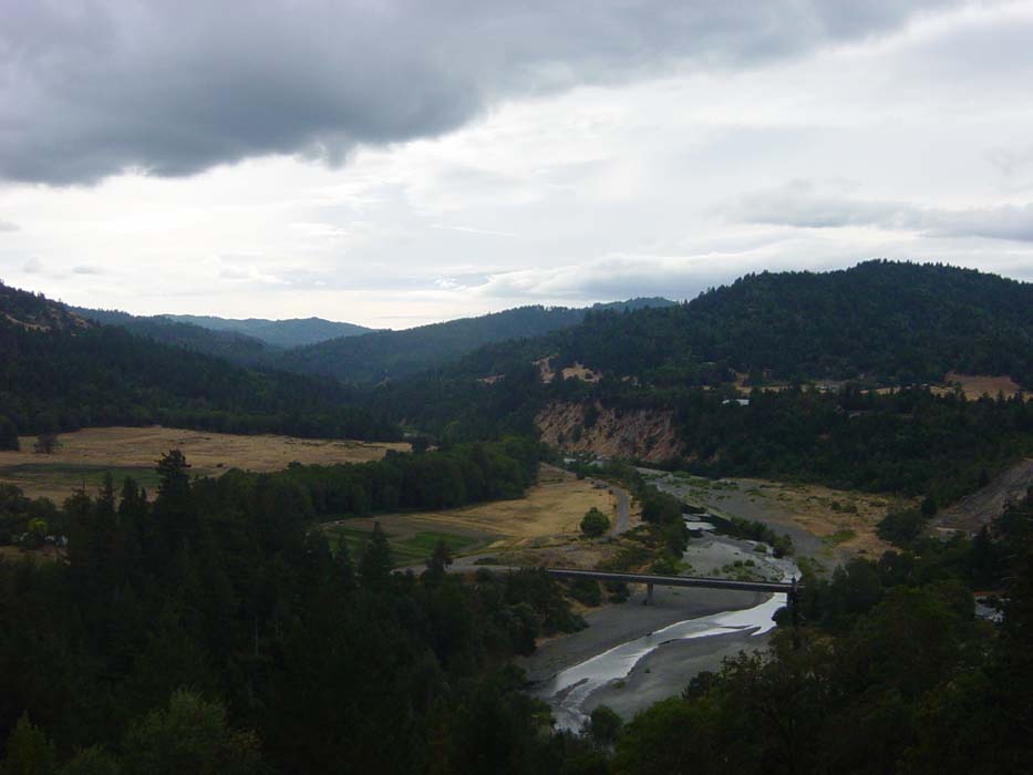
And now back to the freeway where the road began to climb and climb. The hills, which had been fairly moderate until now, became grueling and relentless. I'd get past a mile of 6-7% grade, descend the same amount or less, then start another mile or more. This went on for over 30 miles and took the entire rest of the day (about 4 and a half hours). There weren't even that many good views, this being the only decent one I could find (notice how it's now overcast). It's just the Eel River again, which by now I was quite sick of seeing.
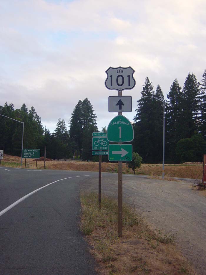
Finally, just over the 70 mile point, I reached Legett and the spot where US Route 101 splits off from California Route 1. Since 101 heads inland and 1 goes back to the beach, you can probably guess which one I'll be on. But that's tomorrow. Now I had to find a place to sleep.
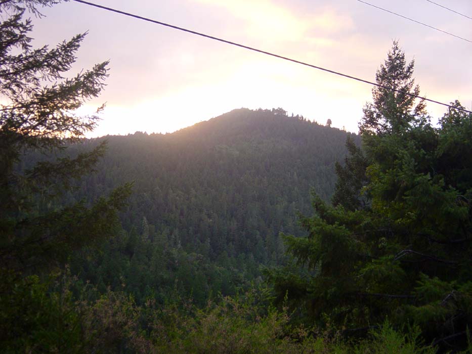
The climbing continued on into Legett, which at first glance had only a post office, pizza place and a grocery store that was closed for renovation. I knew there was a hotel here somewhere, though, and a sign in the grocery said another place was open a mile up the road. When I say "up" I mean it, because that mile was yet another horrendous climb and by now I was totally exhausted. Still no hotel at the top, but I knew I had to be close, and someone in the store told me it was another mile farther up the road. Fortunately this mile wasn't too bad. On the way I snapped this shot of the sunset, which shows you how close I was cutting things today.
There were no other options, so I had to stay in the hotel no matter what, unless I wanted to try "stealth camping" in some hidden spot out of sight from the road. Fortunately for me, the little place I found was cheap ($45 plus tax) and not too bad. The owners were kind enough to let me use their phone (since mine had no service) and also drive me into town to pick up dinner, along with another couple of bicyclists staying in the same place. This couple was from Germany and were riding from Seattle to San Francisco as their vacation. We exchanged stories of the ride so far (since we'd taken almost the exact same route getting here) and I'll probably see them again tomorrow.
This hotel also has no Internet and no television, as Legett is so small they don't have cable and can't pick up local channels due to all the mountains around. Not that I cared. I'm so tired, I'm going to bed as soon as I'm done writing this. Tomorrow promises to be another tough day as I have a monster hill to climb first thing in the morning, and if my leg aren't fully rested it's going to be quite painful indeed.